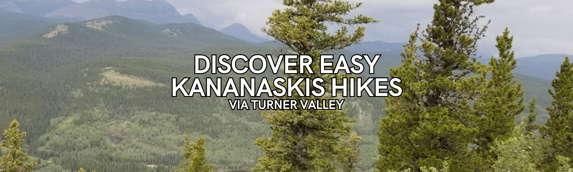
Discover Easy Kananaskis Hikes via Turner Valley
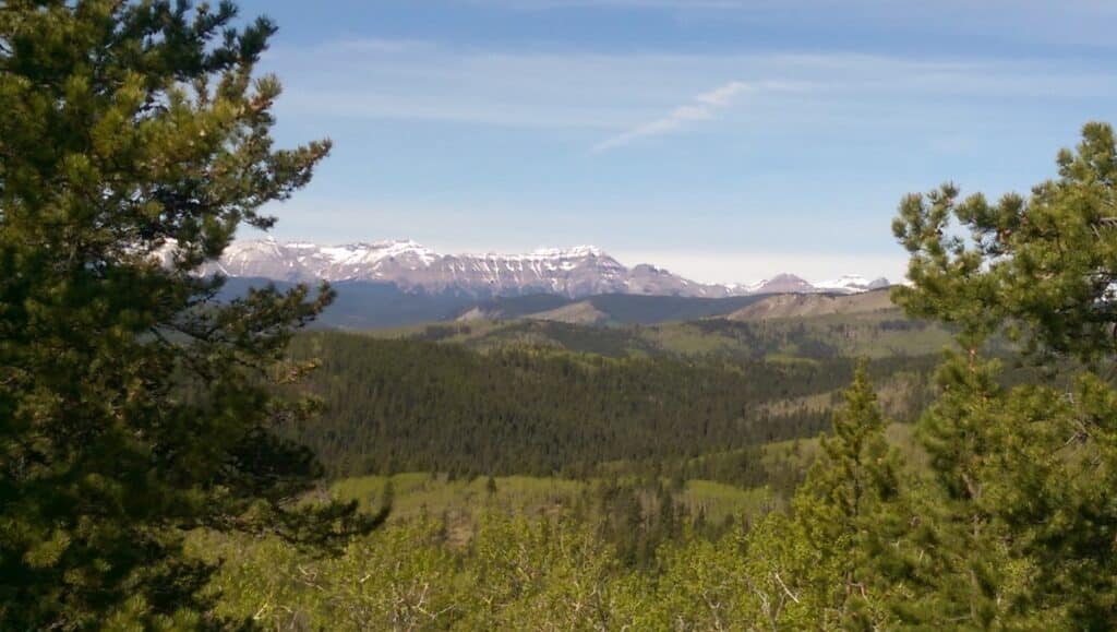
Kananaskis Country is 4,200 square kilometers of a diverse array of landscapes, making it a favorite destination for outdoor enthusiasts. With five provincial parks, four wildland provincial parks, and several provincial recreation areas, there’s no shortage of natural beauty for easy Kananaskis hikes.
Kananaskis is the gateway to the Canadian Rockies and can be accessed many different ways. This guide is for easy Kananaskis hikes accessed from Turner Valley. If you are looking for something a little closer to Calgary, you can find some great hikes closer to Calgary. If you want to venture deeper into K-Country, then head to Peter Lougheed Park for many amazing hikes.
Disclaimer: This post may include affiliate links. If you click one of them, I may receive a small commission at no extra cost to you.
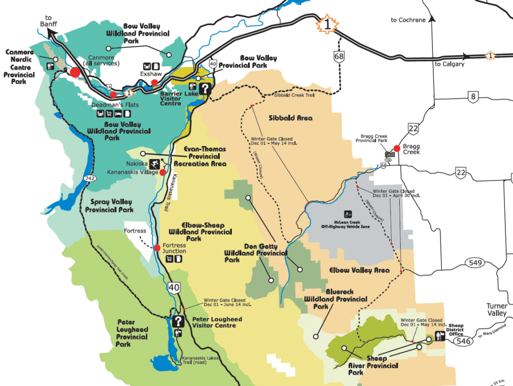
Accessing Highway 546 from Calgary via Turner Valley (Sheep River)
I was born and raised in Calgary and I have been visiting this area for over 12 years hiking, so I am very familiar with exploring here. These easy hikes in Kananaskis are very accessible from Calgary. Take Highway 22 south towards Turner Valley, then turn onto Highway 546 west, leading you straight into the heart of Kananaskis. This scenic drive typically takes around an hour, offering stunning views along the way.
Soon you will enter Bluerock Wildland Provincial Park and Sheep River Provincial Park and the views will amaze you. If you are thinking about starting to birdwatch, there are many species of birds you may see along the way, or while you are hiking. There is also a chance that you may see a bear on the side of the highway or on a trail. To be honest, in all the years I have been hiking in this area, I have never seen a bear, but I still ensure I practice proper bear safety while hiking.
NOTE: Seasonal Road Closure: Highway 546 is closed between December 1st and May 14th, so some of these hikes are not accessible during this time.
Best Easy Kananaskis Hikes via Highway 546
Long Prairie and Pine Ridge Loop
| Location | Distance: 6.4 kms (4.0 miles) | Elevation: 163 metres (535 feet) |
| Loop Route | Washrooms: Yes |
This trail is a scenic walk through rolling hills, offering a couple of viewpoints along the way. This trail can be accessed all year round, as it is located before the gate that closes the highway for the winter season. You start your hike from the Sandy McNabb Equestrian Campground on the right side of the highway.
The loop can be tackled in either direction, both offering a gentle incline and descent. For sweeping views from elevated points, consider taking the higher path along the ridge.If you are new to hiking this is a great easy hike. There are signs at every trail junction to guide your way, easing any worries about getting lost.

Foran Grade Trail – Windy Point Trail – Sheep Trail
| Location | Distance: 6.8 kms (4.2 miles) | Elevation: 293 metres (961 feet) |
| Loop Route | Washrooms: No |
The parking area is located on the side of the highway, therefore there are no washrooms at the trailhead. This route is a connection of three trails that follow a loop. This is one of my favorite hikes to do in Sheep Valley. If you decide to take up winter hiking and do this route when the gate is closed, then you have to park at the gate by Sandy McNabb Campground and plan to add an extra 3.0kms to your hike.
This hike starts as a simple walk on a well defined path that takes you through a meadow and then slowly meanders up the ridge, providing great views of Sheep Valley. Once at the top, you can take a break, enjoy the views and carry on the trail, or you can turn and return the way you came. But I recommend you continue on the trail.
Eventually you will make your way back down and cross the highway for the loop back towards the parking area. Make sure you stop at the bench to enjoy the view of Sheep River. This is one of the best easy Kananaskis hikes in my opinion.
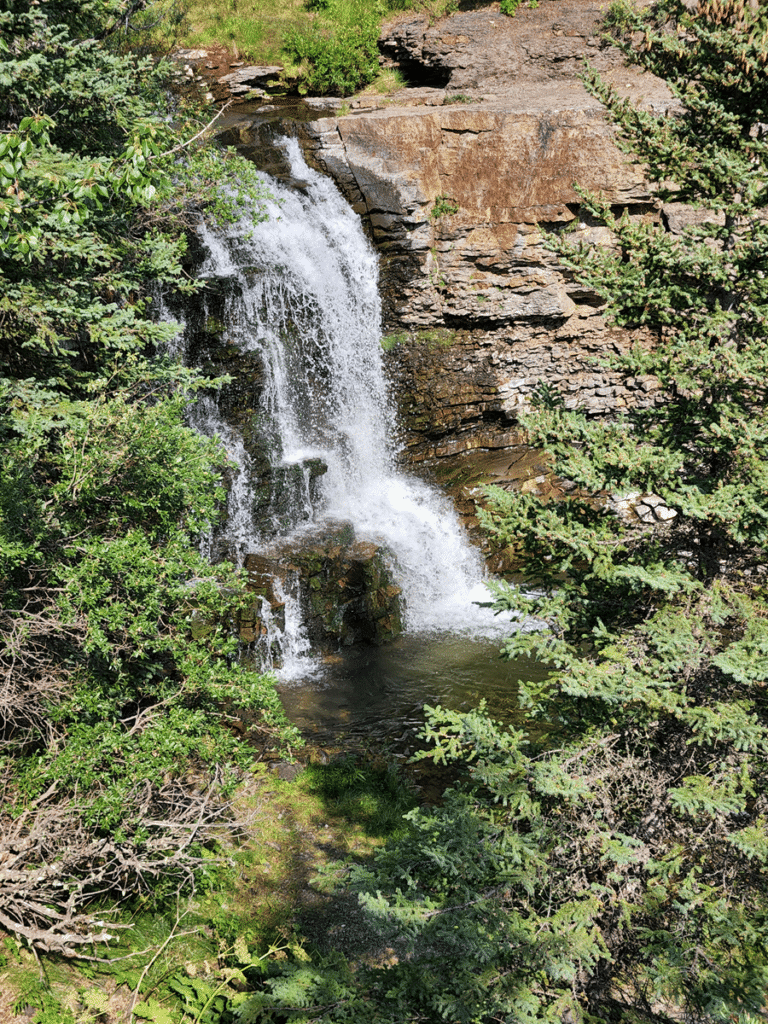
Dyson Falls via Sheep Trail & Green Mountain Trail
| Location | Distance: 8.5 kms (5.3 miles) | Elevation: 297 metres (974 feet) |
| Out & Back Route | Washrooms: Yes |
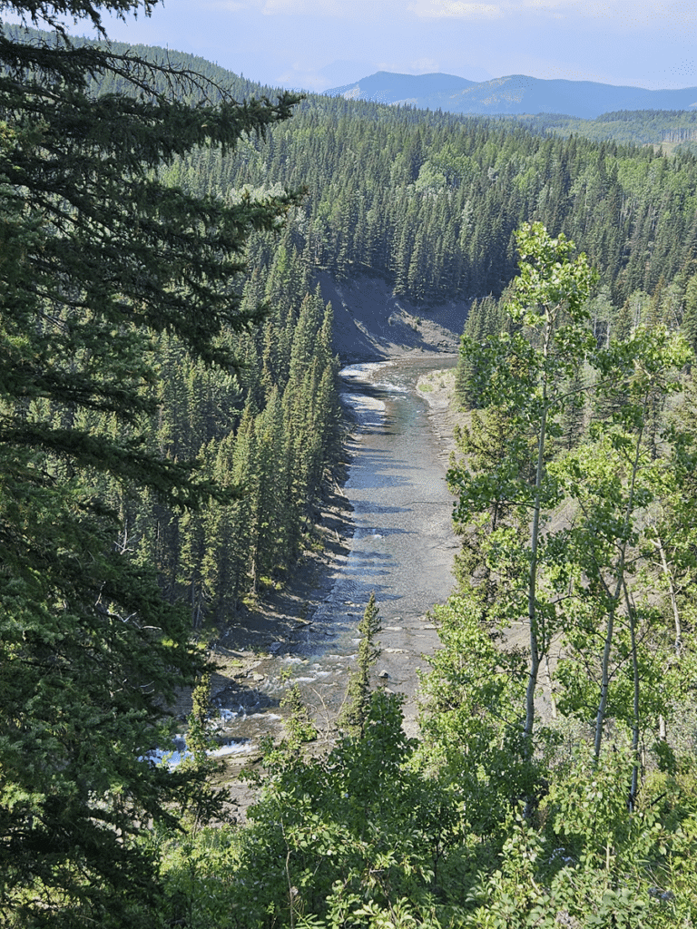
The trail starts from the parking lot at the Indian Oils day-use area. The hike begins from there, just behind the public restrooms in the parking lot. Soon after you start walking, you’ll see a waterfall not too far from the beginning of the trail. You can take a short break there or continue on. You will walk through a meadow and the forest until you reach Dyson Falls at the end of the trail. This is definitely a hidden gem with a beautiful waterfall!
If the water levels are low, you can use the rocks and logs to cross the river near the falls. But if you’re not experienced with river crossings, it’s safer to stick to the trail. Dyson Falls is especially impressive in the spring and fall when the water is flowing strongly. At this point you can turn and head back trekking through the forest along the river or on the trail you came in on. Either way will be a great experience.
Hoffman Humps via Mt Hoffman Trail
| Location | Distance: 6.0 kms (3.7 miles) | Elevation: 303 metres (994 feet) |
| Out & Back Route | Washrooms: Yes |
People usually hike this trail to see Mount Hoffman, not necessarily to climb to its peak. You start from the Indian Oils parking lot. Walk to the end of the lot, which is on the left side when facing the road. Look for a sign that says “Sheep Valley Trails”. Although there are no clear markings for this trail, the official start is to the left of that sign.
Follow the trail, which might have some rocks, until you come to a high bridge over the river. Cross the bridge and follow the wide rocky path to the left. After about 2 kilometers, you’ll see a path on the right that goes straight up the mountain. Follow this trail until you reach a point where it splits. Stay to the right and continue straight up. If you go left at the split, that’s the trail to reach the top of Mount Hoffman.
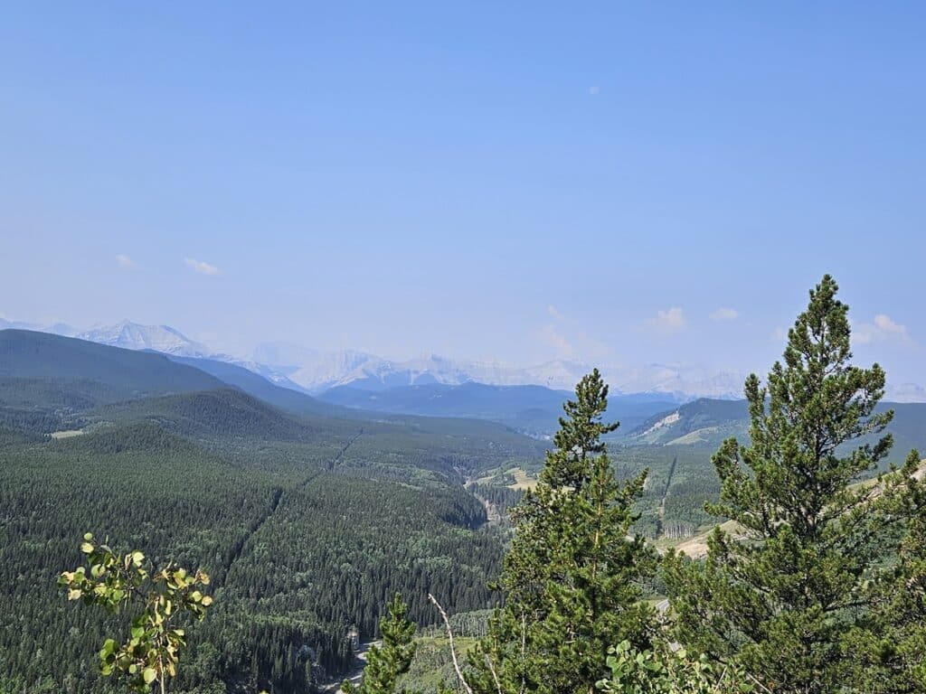
You’ll find a lookout point there where you can take a break, have lunch, and enjoy the views. If you’re up for it, you can climb to the very top for even better photos. The vistas of the surrounding landscape are beautiful. Once you are done, head back down the same way you come up.

Macabee Loop
| Location | Distance: 5.1 kms (3.17 miles) | Elevation: 192 metres (630 feet) |
| Loop Route | Washrooms: No |
This is another trail that can be accessed all year round as it is before the winter gate. It is also a pull out on the side of the highway, so ensure you follow the directions above. Macabee Loop is a simple and pretty hike. You’ll find the start of the trail next to Township Road 194A. You’ll see some fantastic views on the right side. The first part might feel a bit ordinary and stays pretty flat, but the second part gets much nicer as you’ll cross a creek and climb up to the ridge.
Sometimes, you might need to figure out the path a bit because there aren’t any markers. It could help to download the map to make sure you stay on track. To be honest, I got lost on this route, as there was fresh snow on the ground so I lost the trail and couldn’t find it. Luckily I knew where I was, so I just worked my way down the hill to the highway and made my way back to my car.

High Noon Trail
| Location | Distance: 5.3 kms (3.3 miles) | Elevation: 210 metres (689 feet) |
| Out & Back Route | Washrooms: No |
Finding the start of this trail can be tricky, but try to look for a hidden gate surrounded by a fence on the side of the road when you park at the location marked above.
This trail is best enjoyed in the summer when wildflowers bloom. Most of the trail is easy for dogs, kids, and even toddlers who are used to hiking, except for the steep part later on. I always struggle with going down the hill, but just take your time and it is totally doable! You will definitely find a couple of scenic spots to stop and enjoy the views. I remember one day just sitting there at the top of one of the hills and taking in the quietness. It’s definitely recommended to follow an app or map.
Sheep River Falls
Sheep River Falls has easy walks around the area, with areas to sit on the rocks, explore or stop for lunch. Located further down Highway 546, Sheep River Falls is a must visit!

Venturing Further West
If you are looking for something other than these easy Kananaskis hikes off Highway 546, consider heading further west to hike near Canmore or venture into Banff for iconic trails like Johnston Canyon. These hikes are a great addition if you are spending a day in Canmore or a day in Banff. Remember that if you are hiking in Banff, you require a National Parks Pass.
Tips for Enjoying Your Hike
FREE Hiking Checklist
FAQs for Easy Hikes in Kananaskis
These top easy Kananaskis hikes offer a great way to get outdoors, enjoy the mountains and stunning scenery. These trails are doable by hikers of all levels. These routes promise memorable outdoor experiences amidst Alberta’s breathtaking wilderness. So lace up your boots, pack your gear, and embark on an unforgettable journey into the heart of Kananaskis Country.
If you enjoyed my post, follow me on social media or subscribe to my newsletter below, so you can stay connected on future posts, trips, tips and more.