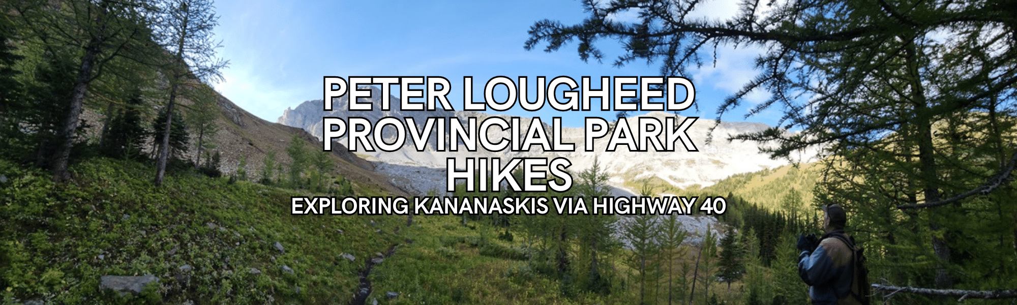
Peter Lougheed Provincial Park Hikes: Exploring Kananaskis
Immerse yourself in another part of Alberta’s Kananaskis Country when you decide to do one of the many Peter Lougheed Provincial Park Hikes. This area is a treasure trove for outdoor enthusiasts, boasting a variety of hiking trails suitable for all skill levels.
Disclaimer: This post may include affiliate links. If you click one of them, I may receive a small commission at no extra cost to you.
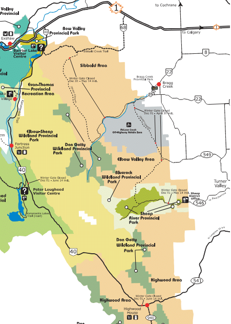
Accessing Peter Lougheed Provincial Park
There are several ways to access Peter Lougheed Provincial Park, but one of the most scenic routes is via Highway 40. Whether you’re coming from the south or the north, Highway 40 offers breathtaking views along the way.
From Calgary, take Highway 22 to Highway 40 towards Highwood Pass for a picturesque journey that takes approximately 1.5 to 2 hours.
Alternatively, if you’re traveling from the north, head out on Highway 1 to Highway 40, where you’ll be treated to awe-inspiring landscapes and roughly the same driving time.
Kananaskis Conservation Pass
In order to do any of these hikes, you must have a Kananaskis Conservation Pass. The pass costs $15 per vehicle per day or $90 for a yearly pass. Purchase the pass online in advance, as you will have minimal, if any, reception when in this area.
The following hikes I have all personally done and some more than once! I am breaking up the hikes into two categories, the south and north ends of Highway 40. Each description below will include a link to the location. I do recommend downloading the AllTrails app as it gives details on the hikes. There is no cell service in most of this area.
Peter Lougheed Provincial Park Hikes at the South End of Highway 40
NOTE: Highway 40 is closed between December 1 to June 15 every year, between Highwood House (Highway 940) to Smith Dorrien (Highway 742) so these hikes on the south end are only accessible seasonally.
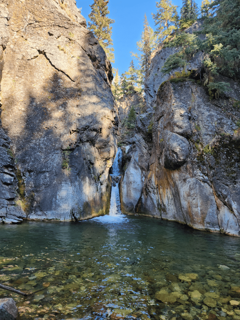
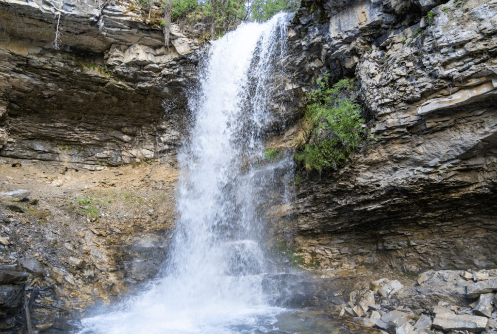
Cat Creek Waterfall
| Location | Distance: 3.0 kms (1.86 miles) | Route Type: Out & Back |
| Elevation: 159 metres (521 feet) | Difficulty: Easy | Access: Year Round |
Starting at the main parking area, the hike is a delightful yet brief journey along a well-marked trail, sure to be busy with fellow nature enthusiasts during the peak seasons of summer and fall. Although the path may narrow at times, the initial steep inclines reward you with stunning viewpoints.
The trail then follows some switchbacks leading downhill to the enchanting Cat Creek Waterfall—a perfect spot for a refreshing swim in the summer. Be prepared for a bit of a climb on your way back. We spent quite a bit of time exploring the area and letting my dog get a refreshing drink of water.
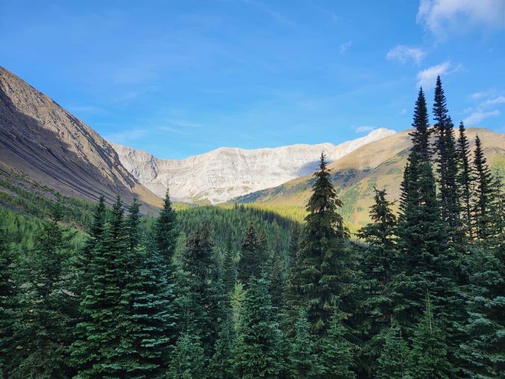
Pocaterra Cirque
| Location | Distance: 7.0 kms (4.35 miles) | Route Type: Out & Back |
| Elevation: 392 metres (1286 feet) | Difficulty: Moderate |
The Pocaterra Cirque trail begins on a broad path from the parking lot, veering left through a clearing and into the forest. After wandering through the woods, the trail opens up, presenting sprawling mountain views. Be aware that multiple branching paths can be confusing, so using offline maps could be handy to stay on track.
As you progress, the scenery stays magnificent, with the trail gradually ascending, though some sections are a bit steeper. When you reach the junction, keep left to tackle a steep climb that leads you above the treeline over rocky terrain, culminating in breathtaking ridge-top views. You’ll return the same way you came.
If you are feeling adventurous, you will see people climbing up the Pocaterra Ridge. Add the extra couple of kilometers and elevation to go to the top. Either way, you will come back the same way.
Arethusa Cirque
| Location | Distance: 4.5 kms (2.8 miles) | Route Type: Loop |
| Elevation: 324 metres (1063 feet) | Difficulty: Moderate |
The loop starts at the far left side of the parking lot, where signs are scarce, so having a downloaded map might be a good idea. The trail takes you up a narrow path alongside a gorge, leading to the top of the cirque, where the ground can be uneven and tricky at times. It was a bit challenging walking along this but is doable if you are careful and take your time.
At the summit, you’re greeted by awe-inspiring views of mountains stretching in every direction —a truly breathtaking sight. Be aware that the trail along the ridge at the top can be difficult to find due to poor markings.
It is recommended to do this hike clockwise and to use hiking poles for stability. If there is snow on the ground then ensure you wear crampons, as it can be a bit tedious.
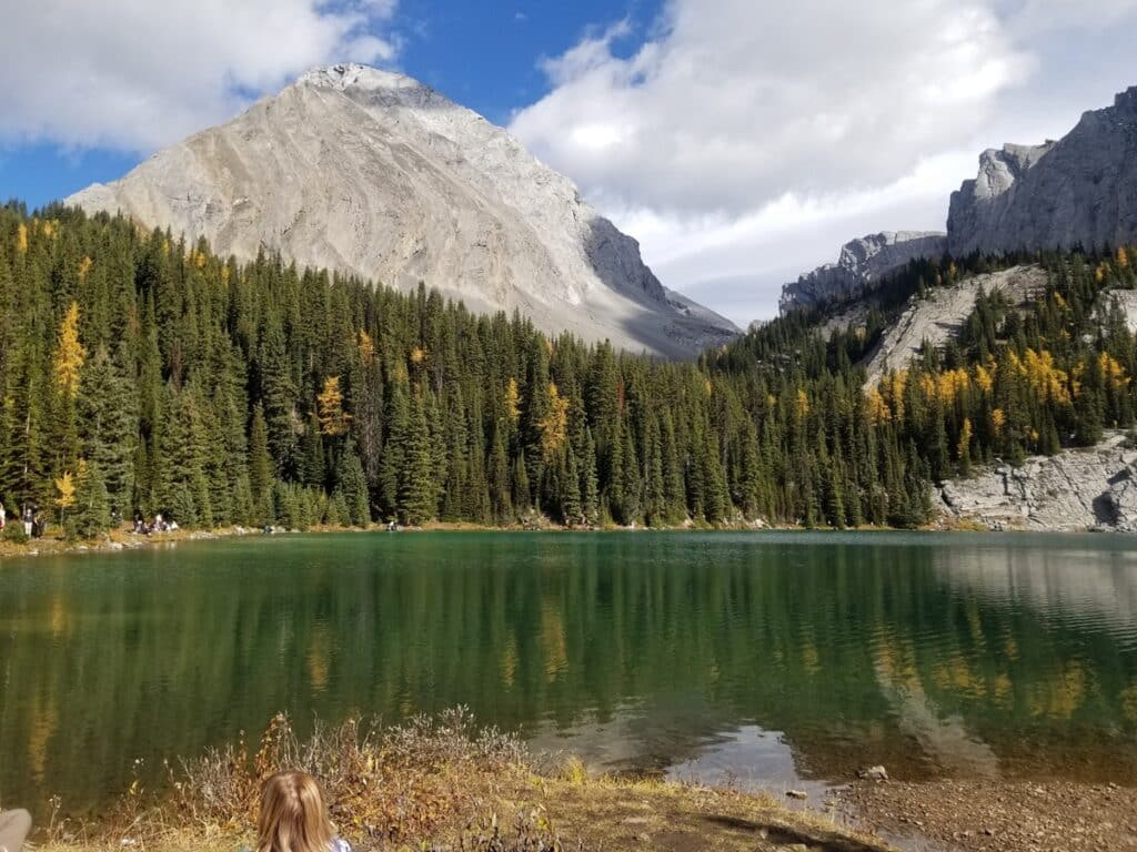
Ptarmigan Cirque
| Location | Distance: 4.5 kms (2.8 miles) | Route Type: Loop |
| Elevation: 214 metres (702 feet) | Difficulty: Easy |
The trailhead for this hike starts at the Highwood Meadows Day Use area. Starting on a broad path, it crosses the highway and then hits steep switchbacks through the forest for about a kilometer—this is the toughest part of the hike. And be prepared, this hike gets super busy! This is perfect for beginner hikers who are just getting started
As you continue, the trail gains elevation and opens up to rocky terrain, offering beautiful views, meadows, and wildflowers in the summer. It narrows into a ridge to complete the loop before it starts the descent. The top can be windy and chilly, so packing extra layers is a smart move. Since this is a delicate alpine region, sticking to the trail is crucial to protect the environment. In this picture, you will see snow. I did this hike in September! That’s the joy of being high in elevation and deep into the mountains. Check the forecast and always be prepared for winter hiking.

Peter Lougheed Provincial Park Hikes at the North End of Highway 40
Troll Falls
| Location | Distance: 4.7 kms (2.9 miles) | Route Type: Loop |
| Elevation: 227 metres (744 feet) | Difficulty: Easy |
The Troll Falls Trail is a great option for families or anyone seeking an easy hike. There are two parts to the trail: one leading to the bottom of Troll Falls and the other above it, reaching a creek and other waterfalls. The first part is easier, while the second requires proper footwear.
The main trail is mostly flat with packed gravel and dirt, suitable for good hiking shoes. Exploring behind the falls might require ice crampons, and the upper trail offers unique sights, including an ice area in winter. We really enjoyed doing both of the routes as it offers a different perspective to the falls, especially in winter. You can say you ‘walked on water.’

Be careful near the cliffs due to rock falls that may occur. Alberta Parks has installed barriers for safety. The parking lot gets busy, especially in summer and on weekends so plan your visit accordingly.
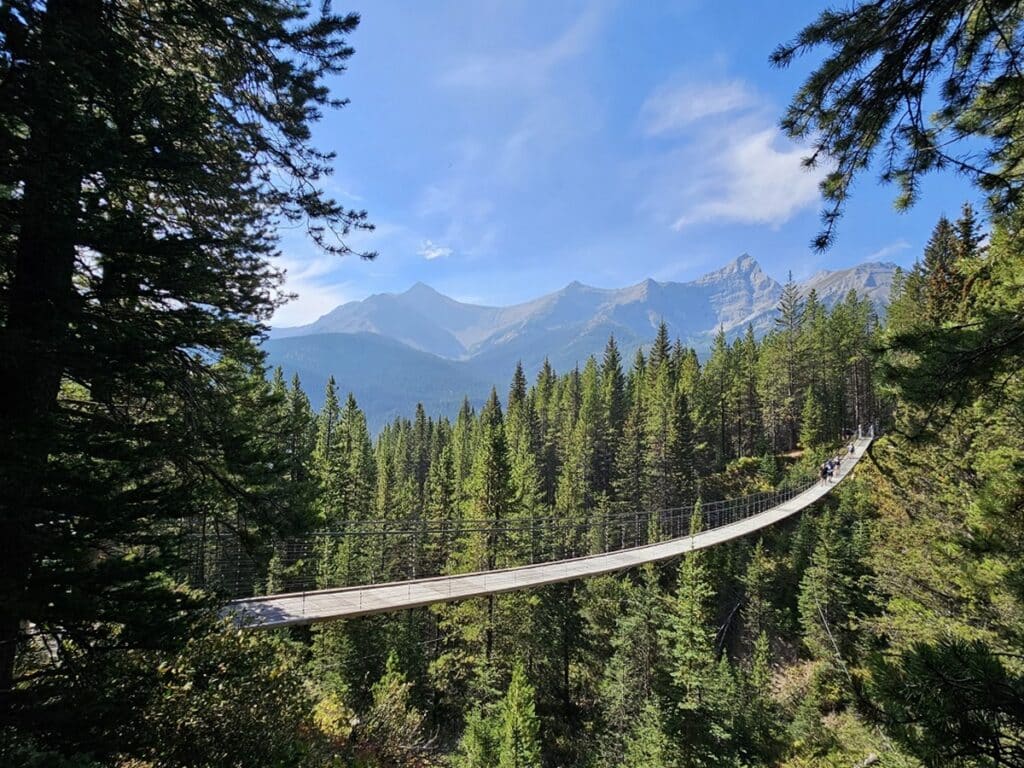
Blackshale Suspension Bridge via High Rockies
| Location | Distance: 7.2 kms (4.5 miles) | Route Type: Out & Back |
| Elevation: 225 metres (738 feet) | Difficulty: Easy |
This is another easy Peter Lougheed hike offering stunning views of the surrounding landscapes and an ideal introduction to Kananaskis Country. I had no idea there was a location like this in Kananaskis! NOTE – there is another way to get to the same bridge. You can do so via Black Prince and it is 6.1kms with a little higher elevation gain of 283 metres.
This trail starts at the South Lawson Peak Trailhead, following the High Rockies Trail to the impressive Blackshale Suspension Bridge. The beginning of the hike is a little boring as you are walking along a road (but on a trail). About 1 km into the hike, there’s a view of Spillway Lake. To shorten the hike, you can drive up the highway about 1.5 kilometers and park on the side of the road. From there, you can easily access the trail on your right to begin your hike.
It’s an easy hike to get to the bridge. Be prepared for alot of people, as it can be accessed from the other side. People wait to cross the bridge, especially if you want to take a picture. We sat and had lunch there before turning and heading back the same way we came in.
NOTE: The bridge closes in winter due to high snow levels so you will not be able to cross it.
Ribbon Creek, Kovach & Terrace Loop
| Location | Distance: 5.3 kms (3.3 miles) | Route Type: Loop |
| Elevation: 202 metres (663 feet) | Difficulty: Easy |
The Ribbon Creek loop is another easy hike in Kananaskis that is popular and accessible. I recommend doing the route counter clockwise which will take you through the woods, offering shade, sunshine, and finishing with creekside views. The trail boasts stunning mountain views, with the best seen from the parking lot at the trail’s start.
Hikers should be cautious of encountering black bears, especially in summer. Waterproof footwear is recommended for muddy spots along the creekside. In winter, the area offers well-marked trails for cross-country skiing, with separate paths for snowshoeing to ensure safety.

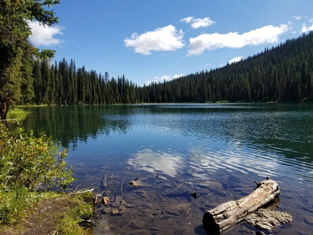
Lillian Lake via Galatea Lakes
| Location | Distance: 15.5 kms (9.6 miles) | Route Type: Out & Back |
| Elevation: 682 metres (2237 feet) | Difficulty: Hard |
Arriving early is advised to secure parking, as the trail gets busy throughout the day. The Lillian Lake Trail offers a picturesque journey through lush forests, with the majority of the trail sheltered by trees. While the mountain views are limited along the way, they become more visible as you approach Lillian Lake. The view is spectacular! I never knew you could find lakes this high up in the mountains. This really is one of the best hikes in Peter Lougheed Provincial Park.
To be honest, this hike was challenging but was so worth it! It is long and there are lots of ups and downs along the way. The link in Alltrails says it is only 12.4 km, and less of an elevation, but sometimes it can be wrong. Once we got to the lake, we enjoyed the views and rested while we had lunch. We did not continue on to Galatea Lake, but I’m including some details below, as provided by another hiker.
Continuing to Galatea Lakes is recommended for the best scenery, although the trail becomes more challenging beyond Lilian Lake. As you progress, you will be treated to increasingly stunning mountain views, streams, and waterfalls. Galatea Lake is cooler, so an extra layer is advisable.
Elephant Rocks via Chester Lake
| Location | Distance: 9.3 kms (5.8 miles) | Route Type: Out & Back |
| Elevation: 419 metres (1375 feet) | Difficulty: Moderate |
Arrive early as this parking lot is big but gets filled up quickly. We started around 9am and we were one of the last vehicles to get a parking spot. The trail begins with a gradual ascent through the forest, gradually becoming steeper until it levels out around 2.6 kilometers in, revealing stunning mountain vistas and a beautiful meadow.
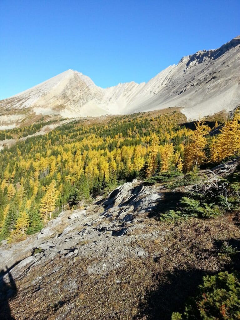
After re-entering the forest briefly, it opens up again at Chester Lake, offering breathtaking views of trees against the mountains. If you visit during the larch season, you will see the amazing golden trees. The trail continues around the lake’s perimeter, becoming narrow, rocky, and root-filled. We sat and enjoyed the view and watched people fishing in the lake.
Once you are done exploring around the lake, take the steep trail up to Elephant Rocks. This is where we had lunch and enjoyed the views. Once you are done, head back the way you came, sharing the trail with all the people going towards the lake.
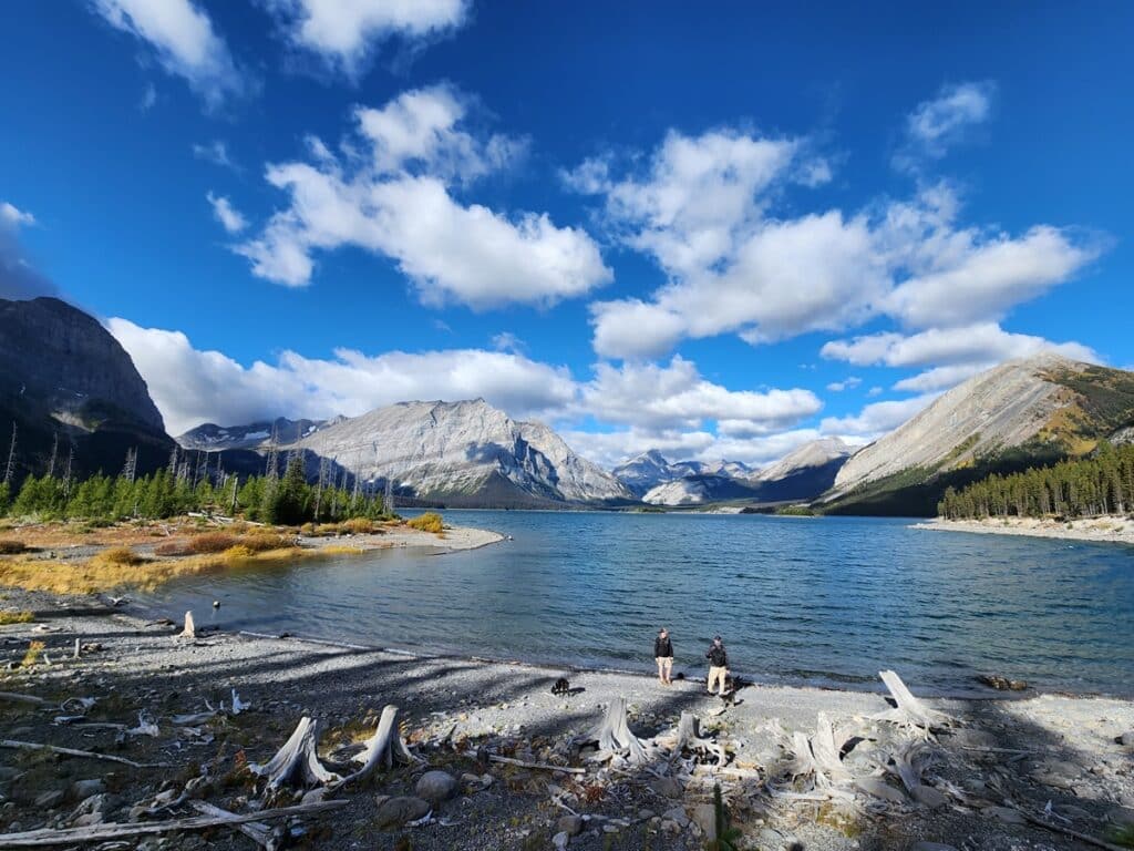
Upper Kananaskis Lake Trail
| Location | Distance: 17.6 kms (10.9 miles) | Route Type: Loop |
| Elevation: 548 metres (1798 feet) | Difficulty: Moderate |
The Upper Kananaskis Lake Trail offers a scenic day hike, best done in a counter-clockwise direction to begin with the most stunning scenery. Note that the AllTrails app says 15.6 kms and elevation gain of 420 metres, but the amounts listed above were what I recorded. We stopped by the lake to have lunch and wow! Such amazing views.
The Interlakes section is the rockiest, but you can turn back after 4 kilometers if you prefer to avoid it – but why do that! You are on an outdoor adventure and will be just fine if you take your time. Eventually you will cross a stream via a wooden bridge and the last 6 kilometers will wind through the forest to finish your long but amazing hike.
Jewel Pass via Prairie Trail (Yates Mountain)
| Location | Distance: 15.4 kms (9.6 miles) | Route Type: Loop |
| Elevation: 740 metres (2428 feet) | Difficulty: Hard |
There are two ways to tackle this mountain. I wasn’t planning on hiking my first ever mountain, but it ended up happening. The other way to hike up is Yates Mountain via Prairie Trail. Sure this hike is 12 kilometres with an elevation gain of 654 metres but it is a much steeper climb. Going the route I’m describing below, you have an easier hike to the peak.
Though it is a difficult hike, it is a great choice for beginner hikers and those with moderate fitness because of its manageable climb and beautiful summit views. Most hikers prefer to go counter-clockwise to avoid steeper parts.
The trail starts easy as you walk along Barrier Lake. When you take the trail up to the right, it starts to gain elevation as you climb Yates Mountain. When you get to the top you can enjoy the amazing views and relish in the fact that you just climbed a mountain. Maybe it will be the first peak you have summited, like it was for me. It may be very windy at the top so be prepared for that.
Once you have rested, head down via Prairie Trail. It starts off with some rocks you have to climb down, which may be a little daunting. Once you are past that, you follow the wide logging trails down. This trail is quite popular, so arriving early is recommended to avoid the crowds.
Exploring Beyond Peter Lougheed Provincial Park
There are many places in the Canadian Rockies where you can go hiking. Hiking in nearby towns like Canmore and Banff offer lots of trails for all levels. Alternatively, for those looking for hikes closer to Calgary, there are easy hikes less than 45 minutes away from the city or a bit further into Kananaskis via Turner Valley. Any of the hikes you choose will provide you with amazing scenery and opportunities to get outdoors.
If you are planning to do one of these hikes on the north end of Highway 40, and you do not want to drive all the way back to Calgary, head to Canmore. With so many things to do in Canmore and great places to stay, planning a weekend trip is easy.
Best Time Of Year For Peter Lougheed Hikes in Kananaskis
With the exception of the trails on the south end of Highway 40, all of these hikes can be done year round. There may be some closures due to the weather during the winter, so ensure you check the mountain warnings.
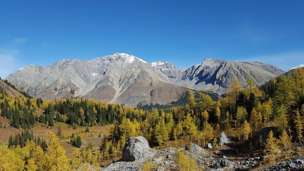
Most of Highway 40 is fantastic for hiking during the fall, especially if you are looking to see the larches at their peak. The best areas are from Highwood Pass through to Barrier Lake to catch these golden trees.
Tips for Peter Lougheed Provincial Park Hikes
FREE Hiking Checklist
The weather can change quickly in the mountains. Dress in layers and carry essential gear. Always be prepared for variable conditions. For comfort and safety on the trails, durable hiking boots with good support and waterproof features are recommended. Download your free hiking checklist:
Embarking on one of these Peter Lougheed Provincial Park hikes will provide a great adventure through the beauty of Kananaskis Country. Whether you seek moderate hikes in Kananaskis or easy trails for beginners, there is something for everyone. So pack your hiking boots, hit the road via Highway 40, and get ready to discover the best that Kananaskis has to offer.
If you enjoyed my post, follow me on social media or subscribe to my newsletter below, so you can stay connected on future posts, trips, tips and more.